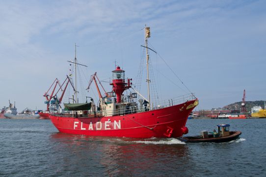
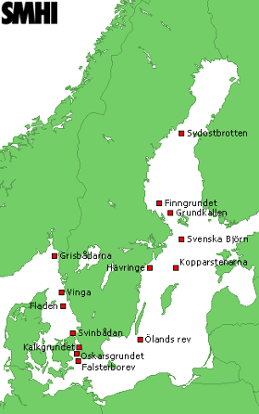
The history of the lightships is described in the book Fyrskepp i Sverige (Werner, 1999). The first Swedish lightship was laid out in 1844 at Falsterborev. From 1860, observations were made of wind, air and water temperature, salinity and current once or twice a day at different depths mainly during May - November. The number of lightships made observations has varied in time but a total of 14 have collected data in different periods.

The measurements began in 1860 as a kind of test operations at Finngrundet and Falsterborev and lasted for some years. Around the year 1880 the measurements were resumed and then started measurements even on lightships at Sydostbrotten, Grundkallen, Svenska Björn, Kopparstenarna Oskarsgrundet, Kalkgrundet and Svinbådan. Measurements at Fladen started in 1893.
Later, measurements at Hävringe, Öland rev, Vinga and Grisbådarna. Some lightship continued their measurements until the 1960’s, Falsterborev until 1972. Interruptions were made during the first and second world wars.

Other hydrographic measurements have been carried out by small boat or from shore. The measurements at Bornö hydrographic station was carried out 1909-1989 and now is only sporadic measurements associated with course activities held here. Hydrographic measurements were made at Varberg 1879-1887, Landsort and Utklippan 1880-1922, Pater Noster 1903-1922 and Hättan and Dynekil 1940-1945.