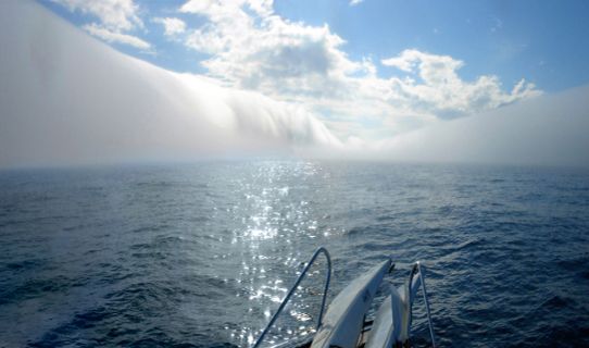
“On Saturday I was out with a friend and navigated in thick fog between Sandhamn and Svenska Högarna. Everywhere was covered in fog the whole day without even a hint of sunshine, when suddenly we sailed out through a wall and found ourselves in an almond-shaped “glade” with clear skies but surrounded by vertical, knife-sharp walls of thick fog. They had a height of perhaps 200-600 m. The width of the glade was 150-200 m and its length 600-1000 m”.
Plausible explanations
Fog is often formed during spring and early summer in coastal waters. The air over the land warms up and as it moves out across a cold area of water it cools and forms fog if the humidity is high enough.
The layer above this cooler layer of air is relatively warm. It acts as a lid that hinders mixing with the air higher up. Otherwise the fog could disappear quickly by mixing with this usually drier air.
At the time of the photograph on 20 May 2006, there was a gentle to moderate south westerly wind over eastern Svealand and the Stockholm archipelago. The weather report from Svenska Högarna was fog with no glimpses of sky.
There are a couple of possible explanations for this phenomenon:
1. The fog belt dispersed as the air passed over an island. This is however quite implausible since there was no island nearby.
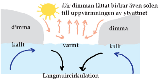
2. The currents and varying water depths created an area with warmer water that dispersed the fog by warming from below which quickly “destroyed” the cold fog layer.
