OceanWeb is designed to be used as a decision support system giving as complete an overview of ocean parameters as possible by presenting ocean information in an understandable way for public, commercial, expert and private users. It provides help in public decision making processes and for planning coastal leisure activities. OceanWeb has been available for many years but is now being re-launched in a new, more accessible form.
Decision-making information for professionals
Do you need oceanographic information to do your job? Do you work with operational oceanography such as warnings or observations, search and rescue, communal or regional planning, coastal/open sea constructions, or oceanographic/climatological research? Go to OceanWeb for an overview of the present ocean state, collect information to use for planning and decision making. Links to statistics and scenarios can also be found at OceanWeb.
Help plan coastal and open ocean leisure activities
If you are a private person considering when to get your boat or jetty out of the water you might want to check the sea levels – what is the level now, what was it yesterday, how much will it rise or drop in the next few days? When’s the right time to do it?
Do you like surfing, diving or sailing? Check out the waves, winds and currents. Do you plan to surf in early spring – go to the temperature forecast and check the surface temperature, maybe you will need your dry suit?
Forecasts and observations for the sea
OceanWeb is a web application for the visualization of ocean observations and forecasts for the seas around Sweden; the Baltic, Kattegat and Skagerrak.
SMHI’s ocean circulation model, with horizontal resolutions of 3 nautical miles over the North Sea and 1 nautical mile over the Baltic Sea makes forecasts for sea levels, currents, salinity, temperature, ice thickness, ice concentration and ice drift. In addition SMHI’s ocean wave model, with horizontal resolutions of 22 km over the North Sea and 11 kilometres over the Baltic Sea makes forecasts for waves.
The following forecasts and observations are available in OceanWeb:
Sea levels
5-day forecasts visualized together with observations are shown for those positions where observations exist and for other positions in the region forecasts only are presented. Observations and forecasts from neighbouring countries can also be seen where available.
Current velocity
Forecasts for 60 hours for surface currents in knots are shown for different areas.
SST & ice concentration
60-hour forecasts for sea surface temperature, ice concentrations and ice drift are shown for different areas.
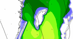
Surface salinity
60-hour forecasts for surface salinity are shown from different areas.
Waves
60-hour forecasts for wave height, wind direction and strength and also air pressure can be seen for different areas.
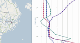
Vertical profiles
Salinity, temperature and current profiles from model forecasts are shown for a number of positions.