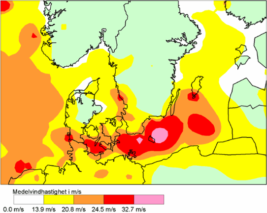
In January 1993 Denmark and southern Sweden were struck by an unusually intensive storm. The extension of the storm is shown in the image below. In the purple areas the wind speed is over 32.7 m/s, which means hurricane. The red areas show storm, with wind speeds over 24.5 m/s.