In the project we collaborate with AGRHYMET as well as various national agencies:
DGRE: General Directorate of Water Resources
DEIE: Directorate of Studies and Information on Water
CONASUR: National Emergency Relief Council
ANAM : National Meteorological Agency
Objectives
The main objectives of the project are to:
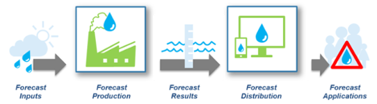
- Make operational flood forecast and alert information (flood hazard summary reports) available through the FANFAR system for Burkina Faso.
- Build capacity on how to integrate new datasets, operationalize and operate the FANFAR system.
- Establish the use of the FANFAR system with national, regional and local institutions.
Project activities
The project activities for FANFAR in Burkina Faso can be summarised in three interlinked activities:
Activity 1: Improve the FANFAR system for flood forecasting and alerts and extend the use and value of FANFAR in Burkina Faso. This activity is made of following components:
- Structure the local hydrometric data in Burkina Faso for forecasting systems.
- Integrate data from local hydrometric stations in FANFAR.
- Integrate new meteorological data in FANFAR.
- Improve the hydrological model HYPE for Burkina Faso.
- Automate the production of flood hazard reports, focusing on providing accessible forecast outputs.
Activity 2: Develop a multi-source forecast visualisation and analysis portal at the national level in Burkina Faso, with focus on developing a visualisation portal for analysing multiple forecast systems on national level in Burkina Faso.
Activity 3: Work with capacity development to reinforce the operational capacity of DEIE/DGRE to interpret and elaborate flood forecasting in Burkina Faso.
The project is implemented using an agile and collaborative development approach, to enhance the sense of ownership and promote long-term sustainability.