The Scandinavian Mountain range is one of the longest in Europe, 1700 km long and up to 300 km wide, located on the western side of the Scandinavian peninsula, with substantial variations in climate depending on latitude, elevation, lee and wind side. The range includes a variety of different ecosystems, from rich and moist deciduous forests to tundra in alpine areas. Biodiversity hotspots are located in both the south and the north.
The northern part of the Scandinavian Mountains is located inside the polar circle, and the Arctic. A wide range of climate scenarios show that the Arctic and also the higher altitudes of the Scandes will likely experience stronger climate change compared with more southern latitudes. Climate models with high horizontal grid resolution become increasingly important as a basis for decision making. A new generation of such models, so called “convection-permitting” climate models have shown superior performance in simulating important aspects of the climate including extremes.
We have performed the first long-term, 3 km resolution, simulation over Fenno-Scandinavia with the HCLIM regional convection-permitting climate model*. This is an unprecedented effort. The use of HCLIM leads to more realistic representation of precipitation compared to coarser-scale climate models. Specific improvements include an increased and more realistic occurrence of higher intensity events, an improved timing and amplitude of the diurnal cycle, and an improved relative occurrence of snowfall versus rain in the Scandinavian mountains.
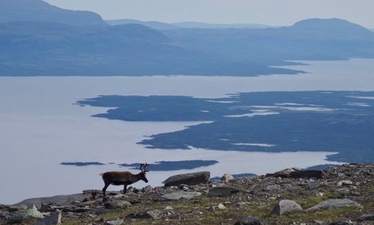
We project continued temperature increase throughout the 21st century, including fewer cold and more warm extremes, and rainfall events in the winter that can change the ecological conditions. We project more precipitation, but with more pronounced wet and dry extremes, and reduced snowfall everywhere except for high-altitude sites in winter. The reduction in snow cover is expected to amplify climate warming. We project more rain on snow events and zero-crossings in parts of the year, with implications for e.g. reindeer management.
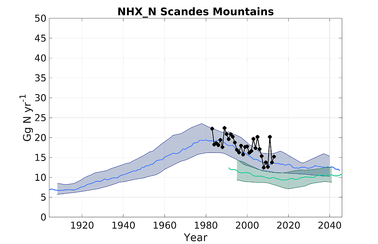
We have studied the impact of climate and emission change on the Scandes ecosystem exposure to nitrogen deposition and near-surface ozone from the 1990s until mid-21st century using the MATCH model*. Our work shows a decrease by 19% in total atmospheric nitrogen deposition in the Scandes from the 1980s until today and continued decrease to mid-century, but still at levels far above the pre-industrial. Reduced nitrogen (NHX_N) deposition is projected to continue at present levels. An increased frequency of extreme events such as the wildfires seen in 2018 (used as an indicator of a possible future year), leads to high input of nitrogen, an increase by 600% in the vicinity of fires and 300% in a vast area of the Scandes. High-growth shipping in the northern seas in 2050 may also contribute to increased total nitrogen deposition in coastal areas of the Scandes, by up to 50%.
Nitrogen deposition impacts biodiversity adversely by promoting specific species over others, while the impact of ozone on wild plants in the Scandes is poorly understood. We project a decrease in ozone exposure in the Scandes until 2050, and very weak climate penalty/benefit in the Scandinavian mountains. However, our observationally-based analyses show that extreme events such as the summer of 2018 where large parts of Europe were affected by a long-lasting heat wave promote high ozone concentrations in south-west Sweden. Additional work is needed to understand the processes of extreme ozone during heat-waves in Scandinavia and flux-based ozone vegetation impacts assessments.
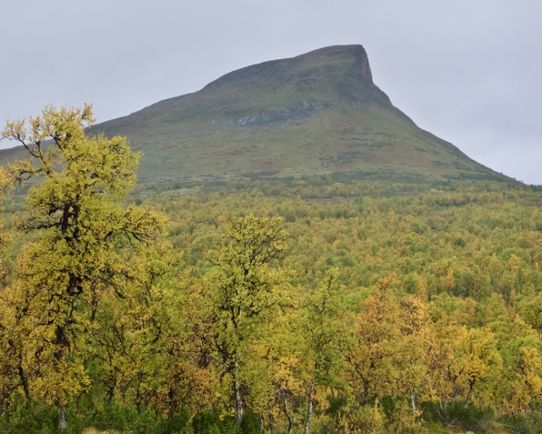
During recent decades, Scandinavian Mountain regions have experienced an advancement of the tree-line. Above this, medium to tall shrub species are observed in moist to wet areas. In dry communities, there has been an increase in semi-prostrate evergreen shrubs like heather and crowberry. Changes in winter conditions are also common with more frequent episodes of winter warm spells, ground icing and rain-on-snow events damaging vegetation and altering ecosystem services such as carbon storage and grazing grounds for reindeer husbandry.
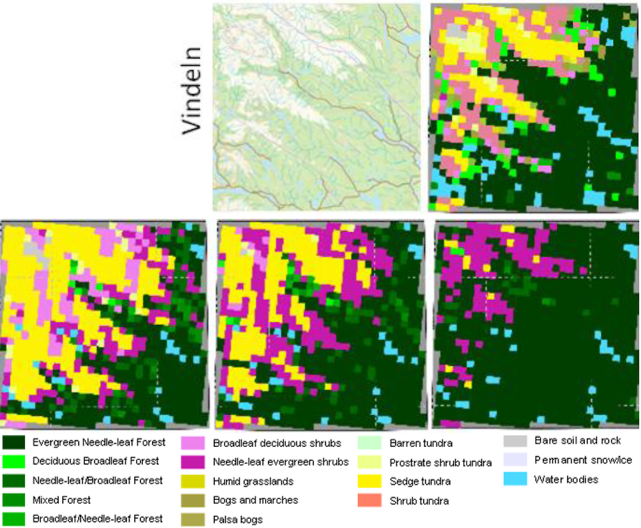
We further developed the leading ecosystem model “LPJ-GUESS” to investigate how vegetation in the Scandes is likely to respond to the climate and air quality scenarios described above. The scenarios’ extremely high spatial resolution of 3 km allowed us to model in unprecedentedly fine detail the vegetation dynamics across the Scandes, and to zoom in on six specially-selected “hotspot” areas for which we compiled records of rare and threatened animal and insect species. Our results suggest that increasing temperatures and carbon dioxide concentrations during the 21st century will likely lead to increased vegetation productivity overall, characterized by generally taller and denser vegetation. Our hotspot analyses suggest that the southern alpine region in Sweden will be dominated by (increasingly mixed) forests at the end of the 21st century, putting many rare and threatened species at risk. In the northern alpine regions, most vegetation types will persist but we project a shift of trees and shrubs to higher altitudes with some species being restricted to small regions, endangering vulnerable species that depend on these habitats. Tree-line advance will proceed more slowly than climate change, due to the competition from prevailing vegetation and a threshold for establishment of new species. Furthermore, the projected vegetation changes are likely to impact the character of existing reindeer grazing grounds, making adaptation necessary. In spring, summer and autumn, potential reindeer consumption is projected to increase, most dramatically during the summer at higher latitudes. Temperature was found to be a strong driver of vegetation change, with nitrogen availability identified as an important modulator of treeline advance.